Tracking the rivers under our feet
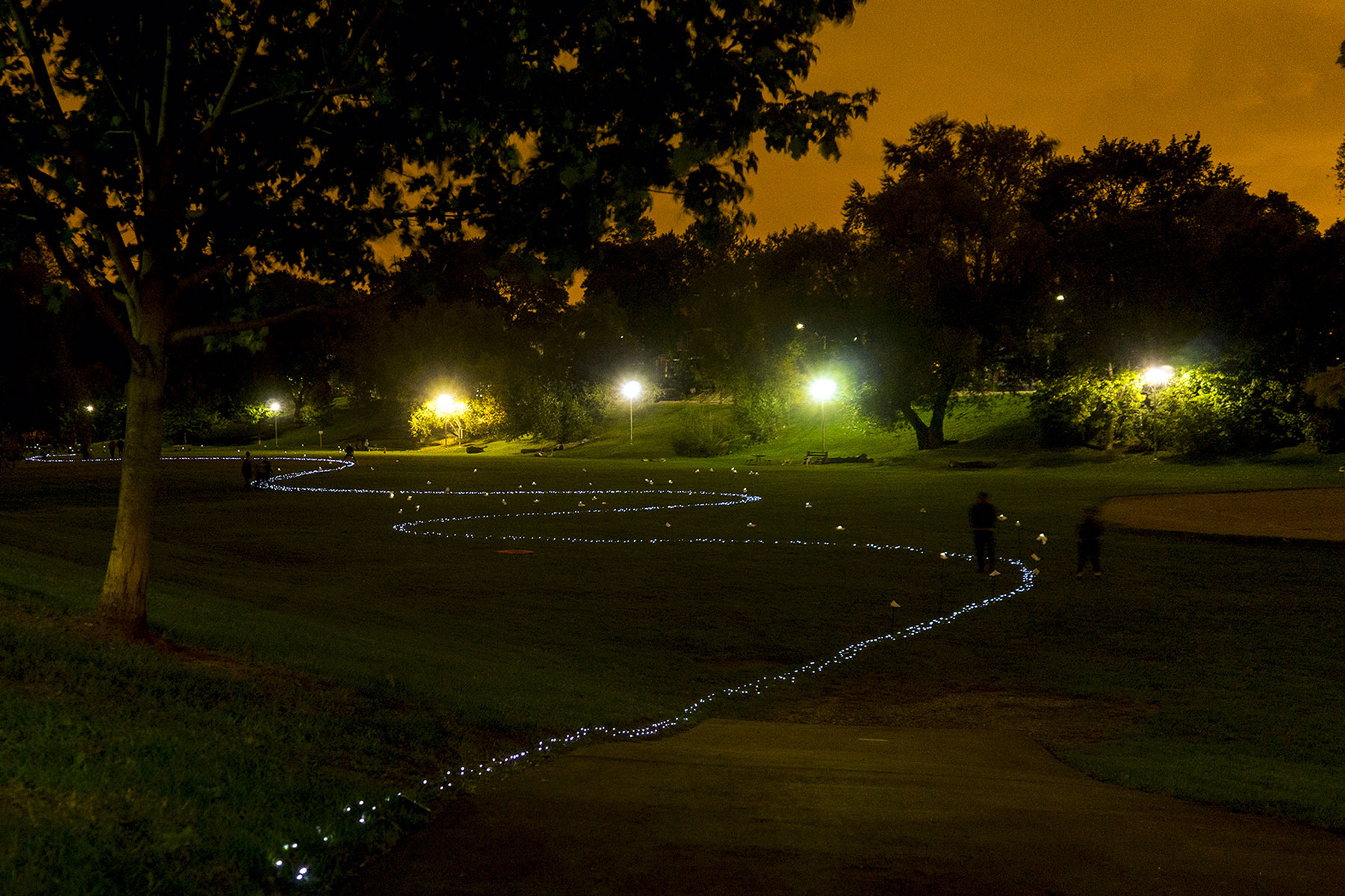
PHOTO BY NEILAND BRISSENDEN/GLEANER NEWS FILE: The area’s lost rivers have long been a source of fascination for artists and writers. In this 2015 Nuit Blanche installation, To Love You Deeply I Look to My Mind’s Eye, visual artist Christine Dewancker and landscape designer Katie Strang tracked Garrison Creek through Bickford Park to explore the impact of an invisible geography — such as a lost river — on a community.
By Geremy Bordonaro
It may be hard to fathom now, but the Annex was once home to three major creeks: Taddle, Garrison, and Russell. They are the area’s lost rivers, buried or incorporated into the city’s sewage system in the late 1800s.
“For people, it’s often like ‘Oh my god. Now I know why I have a wet basement or I get flooded.’ Or ‘Oh my god I used to play in this creek when I was a kid,’” said Helen Mills, coordinator of the Lost Rivers walks, which trace their trajectory.
Henry Scadding described Russell Creek as “meandering most recklessly through the fields”.
She said that though Taddle and Garrison creeks are relatively well-known throughout the neighbourhood, Russell Creek is new to many people.
“Russell is lower and less famous but pretty cool actually. It starts northwest of Bathurst and Harbord [streets] and flows south right through Kensington Market and Chinatown,” said Mills, adding that mid-1800s clergyman and scholar Henry Scadding described it as “meandering most recklessly through the fields”.
Mills has studied the rivers and their place in Toronto’s ecological history for years. She believes it is important to learn about the rivers, because “there’s a whole layer of meaning that comes with that knowledge.
“For most of us our frame of awareness is probably the city grid or the transportation lines, work or home. This is a way to discover the fabric of the life support system of the city. It changes your sense of connection to this place where we live.”
You can follow the lost rivers by connecting the dots between canoe gardens that attract bees and butterflies installed by Community Canoe.
“[We are] using canoes as a vehicle to get the message out there about pollinators and lost rivers in the city,” explains organizer Aidan Nolan, who says the canoes also serve as a reminder of the Indigenous people who once lived by the rivers.
“We are marking the route of the rivers and building a habitat. In the Garrison Creek area, our canoes are on top of where the rivers went. In other places, we’ve been closer to the river but not exactly on top of it. It’s a physical and visual marker of where these rivers were.”
READ MORE:
ON THE COVER: Tracking history in the Annex (April 2016)
Canoe garden lands on the shore of Lake Iroquois (May 2015)