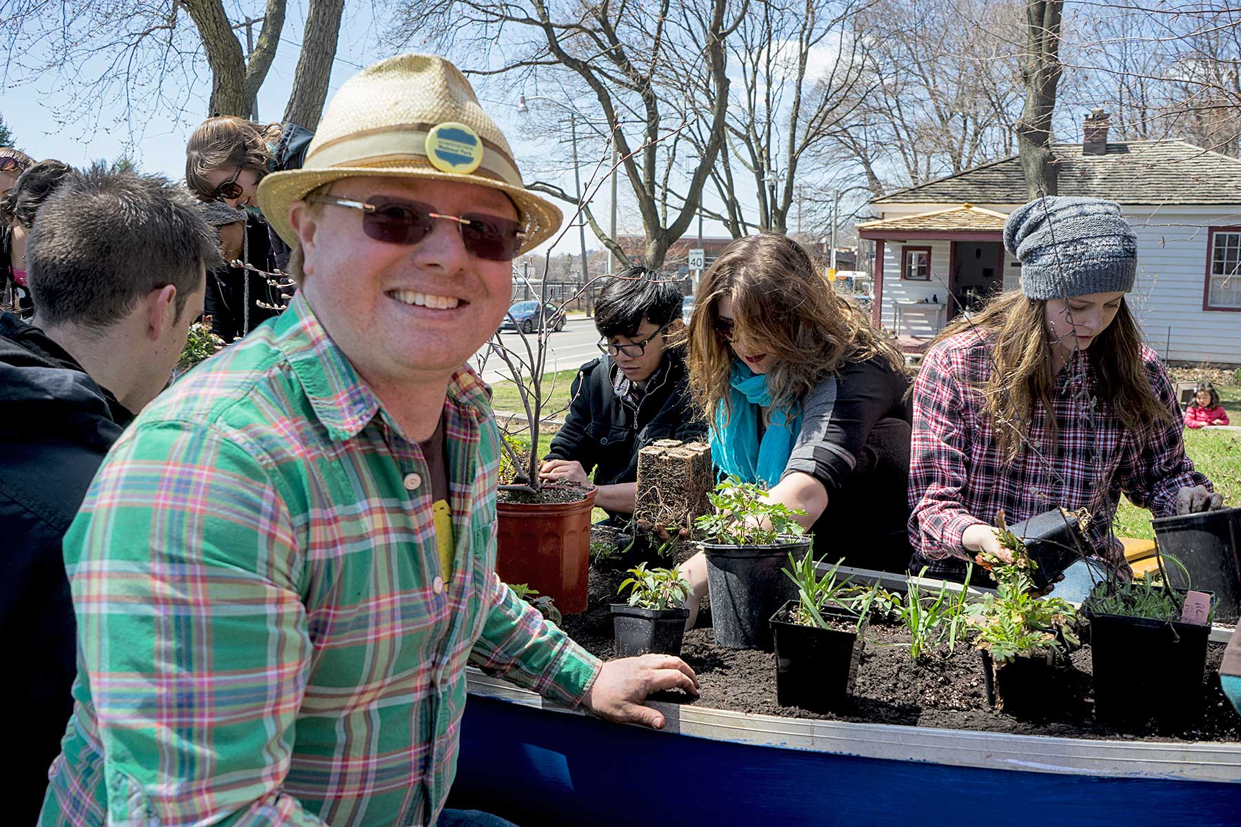
Led by David Suzuki Foundation Neighbourhood Park Ranger Aidan Nolan (above left), volunteers transform a canoe into a garden in front of the Tollkeeper’s Cottage at Bathurst Street and Davenport Road. A Community Canoe Garden Network initiative, the garden — one of 11 installed along the corridor of old Garrison Creek — creates an abundant habitat for bees, birds, bats, and butterflies while reminding residents of the lost rivers that flow beneath the city. Photo: Neiland Brissenden, Gleaner News
A native plant garden is taking root in a derelict canoe positioned on what was once the shore of a lake dating to the last ice age. Located in Tollkeeper’s Park at Bathurst Street and Davenport Road, it is one of 20 urban installations that will make up the Community Canoe Garden Network, itself part of the Homegrown National Park Project. Each canoe garden is beached along Garrison Creek, one of the city’s old waterways, and provides a habitat for local bees, bats, butterflies, and birds.
Aidan Nolen, a David Suzuki Foundation volunteer, which the foundation terms a Neighbourhood Park Ranger, is leading the initiative, and planning to install nine more community canoes this year.
“Nolan is a super volunteer who has committed an extraordinary amount of time and energy to this cause,” said Jode Roberts, a foundation staff member. “He has taken it a step further by including an educational component about lost rivers, and has started to include First Nations groups who identify with the canoe as a cultural symbol.”
A corridor for native and European travellers alike for generations, the location of this particular canoe is especially historically significant.
All of downtown south of Davenport Road was once under Lake Iroquois, until approximately 12,000 to 13,000 years ago, when the last ice age ended and the receding waters formed Lake Ontario. Still visible, the old shoreline is noticeable in the dramatic changes in elevation at Bathurst Street north of Davenport Road.
Thought to have been a trail stretching from Montreal to Niagara, this route along the edge of an ancient lake was documented by Elizabeth Simcoe (wife of then Lieutenant-Governor of Upper Canada John Graves Simcoe) in 1776. Only the section between the Humber and Don rivers is in its original location.
The Tollkeeper’s Cottage, also part of the park, is a museum about tolls, roads, and nineteenth-century life. The oldest structure of its kind Canada, it dates to 1835, a time when private developers built roads, and charged all those travelling along them a fee, or toll, per use. Think of it as an early Highway 407 built on a native pathway.
Interested in hosting a canoe installation? For further information, or to make a donation, please visit www.communitycanoe.ca.
—Brian Burchell/Gleaner News